Five and a Half Percent: Inside the 2026 Swiss Glacier Collapse
On June 29, 2026, the last patch of winter snow melted off Swiss glaciers and bare ice stood exposed to the summer sun. GLAMOS, the Swiss Glacier Monitoring Network, calls this date Glacier Loss Day. In 2026, it arrived earlier than almost any year in the observational record, and what followed was the second-worst ablation season Switzerland has ever measured.
By September, Swiss glaciers had surrendered 5.5% of their total ice volume in a single summer. The only year worse was 2022, when the loss hit 6%. String those numbers together across five years and the picture sharpens fast: between 2021 and 2026, Switzerland lost nearly 20% of its glacier mass. One fifth of what took millennia to accumulate is now meltwater in the Rhine and the Rhone.
The thickness figures make the abstraction physical. Across the country, glaciers thinned by an average of 2.5 to 4 meters of vertical ice in 2026 alone. At the most exposed glacier tongues the loss reached 10 meters. Stand on one of those spots and you would be standing 10 meters lower than you were in 2025.
Two drivers compounded each other with unusual efficiency. Summer heatwaves pushed surface temperatures to record highs. But the engine was already running before the heat arrived: the 2025-2026 winter ranked among the ten least snowy on record.
Snow reflects solar radiation; ice absorbs it. Strip away the reflective shield early, and every additional day of sun goes directly into melting the ice beneath. The glaciers arrived at summer already defenceless.
Matthias Huss, who leads GLAMOS, did not search for diplomatic language: "Many glaciers are now completely devoid of ice, resembling a dry and dead moon landscape." That is not a poet's metaphor. It is a field observation from a scientist who has been counting ice for decades, and who found, in 2026, that the counting had become harder because there was less left to count.
When the Ice Goes, the Ground Follows
Two glaciers no longer exist. Bella Tola and Griessfirn vanished completely in 2026, their names struck from the Swiss glacier inventory by ETH Zurich. They are not retreating. They are gone.
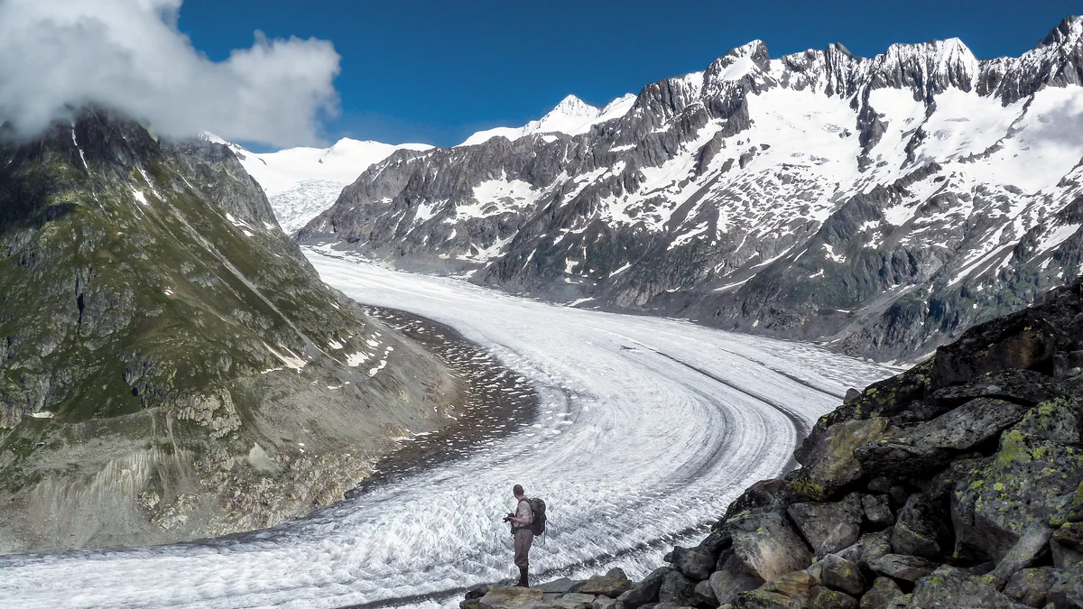
The Aletsch Glacier, the largest in the Alps, is still there — but 4.6 meters thinner than it was in 2025. That is not a rounding error. On a body of ice that took millennia to accumulate, losing nearly five meters of vertical thickness in a single year is the kind of number that rewrites engineering assumptions about everything downstream.
The more immediate danger is structural. When the Birch Glacier collapsed in 2025, it sent debris into the village of Blatten. Secondary collapse risk remained active throughout 2026, a slow emergency that no headline can fully capture. Glaciers do not just shrink. They destabilize the ground they leave behind.
Permafrost is the mechanism. It acts as structural glue for Alpine rock faces, holding fractured stone together. As it thaws, the adhesive fails.
In August 2026, authorities issued evacuation leaflets to residents of Kandersteg because permafrost melt was destabilizing the Spitze Stei rock face above the village. That is not a precaution for some distant future scenario. That is a leaflet through a letterbox, now.
On the tongue of the Rhone Glacier, GLAMOS researchers documented deep collapse pits forming where internal meltwater cavities had hollowed the ice from below. The surface looks intact. Underneath, the structure is failing.
The damage, as researchers in a separate study on glacier fracture mechanics put it, is dominated by fracture rather than melt — the visible retreat is only part of what is happening. The pattern across all five cases is the same: ice loss is not a slow, manageable retreat. It is a cascade, and the ground does not wait for the ice to finish melting before it starts to move.
Ice loss is not a slow, manageable retreat. It is a cascade, and the ground does not wait for the ice to finish melting before it starts to move.
Listening to the Ice Before It Breaks
The collapse at Blatten did not announce itself. The Birch Glacier fractured fast, sending debris into the village below, and the monitoring systems watching its surface could only confirm what had already happened. That gap, between the first internal crack and the visible catastrophe, is where the real work now sits.
Researchers using distributed acoustic sensing, fiber-optic cables laid across or drilled into glacial rock, can now map subsurface fracture networks before any calving is visible from above. The signal travels through the ice; the geometry of the damage shows up in the data.
A 2025 study in Science Advances put it plainly: "Damage is dominated by fracture rather than melt." That single finding flips the monitoring logic. Surface melt rates, which satellites have tracked reliably for decades, are not the primary mechanical driver of catastrophic collapse. The fracture network is.
That shifts the practical question from "how much ice is left?" to "how close is the next failure?" Fiber-optic seismology offers a genuine lever here. It is not cheap, and not every glacier in Switzerland has a cable running through it. But for glaciers sitting above inhabited valleys, the installation cost looks modest against the cost of an unannounced collapse.
Satellite-based alternatives remain appealing in theory. Shortwave-infrared spectral imaging, which reads surface wetness as a potential precursor signal, has been tested at multiple sites. So far the results are inconclusive at the site-specific resolution needed for early warning; it did not produce a usable signal at Tsangbu Ri.
The subsurface approach is harder to deploy, but it is the one producing actionable data.
Two Trillion Liters and Where They Go
Picture the Rhine on a July morning in 2026: the river running fast and murky, banks pushing close to the edge, Swiss hydropower engineers watching gauges that swung between flood warnings and drought projections within the same week. The cause was upstream, in the Alps, where 2.2 trillion liters of meltwater poured off Swiss glaciers between May and September. That is roughly 880 Olympic swimming pools emptied every hour for five months straight.
The water had to go somewhere. Alpine glaciers feed the headwaters of the Rhine and the Rhone, two rivers that between them carry freight, cool power stations, and irrigate crops across much of central and western Europe.
An erratic pulse of meltwater disrupts all three functions simultaneously: too much water too fast clogs navigation channels with sediment, overwhelms cooling infrastructure, and then recedes before summer crops need it. The flood masks the cliff that follows.
That cliff is the harder story. The surge of 2026 will not repeat indefinitely. Ice that melts this summer cannot melt again next summer. Within two decades, the same rivers that ran high in 2026 will run lower than they have in living memory, as the reservoirs stored over centuries in alpine ice approach empty.
There is an additional forcing that is easy to miss in a summer of dramatic headlines. Low-frequency modes of ocean variability — slow, multi-decadal shifts in sea surface temperatures — can accelerate glacier disintegration timelines by up to 250 years. The engine driving Swiss Alpine ice loss is not only the local heat dome above the Alps; it is embedded in planetary circulation patterns that no single country controls or can quickly reverse.
More water now. Far less within two decades. That is not a paradox. That is a supply cliff with a long run-up.
Peak Extinction Is a Deadline, Not an Epitaph
ETH Zurich puts the window for "Peak Glacier Extinction" in the Alps at 2033 to 2041. By then, most smaller glaciers will be gone regardless of what emissions do between now and that date. This is not a prediction that can be revised with better behavior.
The physics are already committed. That boundary matters because it separates two different problems. The small glaciers are sunk costs; the larger ones are not.
Emissions reductions still determine how much ice the Aletsch and its peers retain through mid-century and beyond. The window to influence that outcome is open, and it is narrower than a decade.
The historical comparison is useful here. The Dutch did not mourn the sea; they built the Delta Works. The question facing Alpine water managers now is the same in structure: not whether the landscape changes, but whether the infrastructure changes fast enough to keep pace with it.
Here is what the engineering calendar actually requires. Reservoirs designed for steady seasonal melt need redesigning for erratic surge inflows, because a glacier that runs down 4.6 vertical meters in a single year produces floods and droughts in the same season, not a smooth supply curve. Crop calendars in the Rhone and Rhine basins need revision to account for earlier, sharper melt peaks.
Mandatory fiber-optic sensor networks on unstable slopes are not a research project anymore; they are overdue infrastructure.
The honest scorecard on the Swiss glacier collapse: the small glaciers are already an epitaph, and no policy reverses that. The larger ice bodies and the water systems that depend on them remain a genuine decision. That decision belongs to reservoir engineers, cantonal water authorities, and the agricultural ministries downstream — and the deadline on their calendar reads 2033, not 2100.