Fifty Districts, One Signature, and a Number the City Has Known for Decades
In October 2011, the Thai government spent weeks insisting the Bangkok floodwaters would not reach the capital. The floodwaters reached Bangkok. What followed cost the economy over 1.4 trillion baht and installed a permanent anxiety at the base of every monsoon forecast the city has issued since. Fifteen years on, the anxiety has a new entry in the ledger.
On September 26, 2026, Governor Chadchart Sittipunt signed a disaster declaration covering all 50 districts of the capital, made retroactive to September 25. The legal instrument exists to unlock emergency funding and coordinated response — it is bureaucratic architecture, not a diagnosis of surprise. What it named, the physical record had already written.
Three hundred millimetres of rainfall in 48 hours. The resulting volume: an estimated 30 million cubic metres of water moving through a city designed, on its better days, to handle rather less. The initial declarations had concentrated on three eastern districts — Nong Chok, Suan Luang, Khan Na Yao — where the canals backed up first and the streets disappeared earliest. The 50-district signature followed as the water spread west and the logic of partial containment collapsed.
The number 300mm is not exotic for Bangkok in September. That is precisely the point. The city has absorbed similar figures before, through a combination of canal management, pump capacity and the tolerance of residents who have long treated flooded ground floors as a seasonal condition. What the declaration signals is not that the rain was unprecedented. It is that the margin available to absorb it has narrowed, and the narrowing has a direction.
What Bangkok's Flood Declaration Looked Like at Street Level
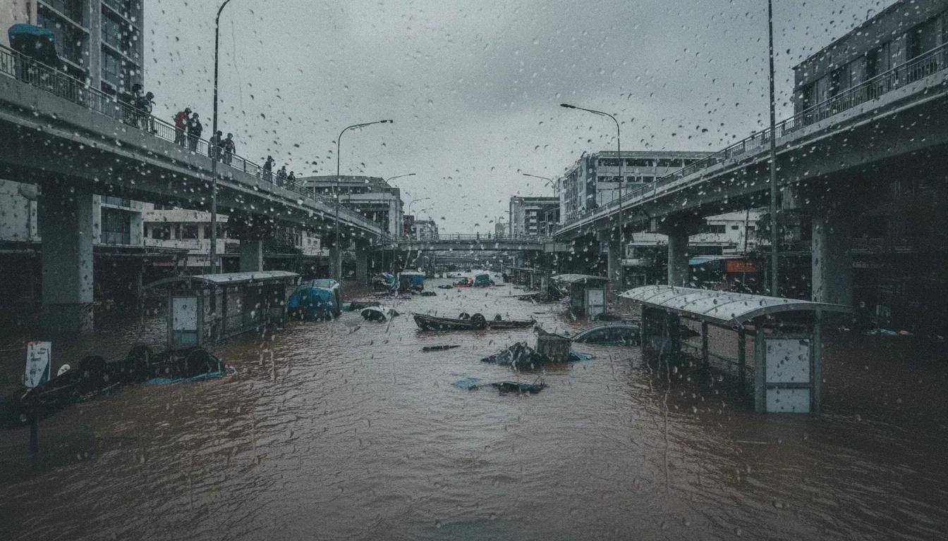
The paperwork named fifty districts. The streets had already voted. On Ekkamai, Vibhavadi Rangsit and Ramkhamhaeng, small cars stopped moving — not stalled, simply stopped, the water above the door sill and the channel beneath the asphalt invisible. A city of ten million reorganised around what it could not pass through.
The Bangkok Metropolitan Administration had pre-positioned one million sandbags. That number sounds like preparation; it is also a measure of what the drainage system cannot do on its own. City-run schools became the primary shelter network for displaced residents, their classrooms converted by the same bureaucratic logic that had converted them to vaccination centres and polling stations before. Ramkhamhaeng University shifted to online classes, a routine adjustment by now in a city that has learned to keep one foot in the dry register.
Thirty-six bedridden patients were identified and moved to shelters. The number is small enough to be precise, which is exactly why it carries weight. Every flood map has a most-vulnerable stratum — the people who cannot walk to higher ground when the announcement comes — and the response to that stratum is the load-bearing test of any emergency plan.
Moving thirty-six people required that someone had a list, that the list was current, and that transport arrived before the water did. On September 25, it did. That is not a small thing. It is also the minimum threshold, not the ceiling, and the gap between the two is where the next flood will find whatever was left unprepared.
The Arithmetic of the Pumps
The Bangkok Metropolitan Administration operates pumps rated at 1,200 cubic metres per second. The September event deposited an estimated 30 million cubic metres of standing water across the capital. Do the division: even running at full capacity, with nowhere for the discharge to go, the system needs hours it does not have before the canals themselves become the problem.
They became the problem. Current drainage infrastructure is engineered to handle approximately 76mm of rain per hour. The sky delivered 300mm over 48 hours, with the heaviest falls compressed into a shorter window.
That is not an infrastructure failure in the ordinary sense — it is a design specification meeting a climate that has moved on without consulting the specification.
The canal backlog is the figure that matters most right now. East of the Chao Phraya, drainage is expected to take two to three days once the rain stops — and that estimate assumes the canals can accept what the pumps push into them. Full canals cannot.
Chadchart Sittipunt acknowledged as much: the river system is saturated, and saturated receivers do not drain. The queue builds from both ends.
The JICA partnership carries a target of 100mm per hour once the Urban Drainage Grand Design reaches completion. That is a meaningful upgrade from 76mm. It is also less than a third of what September delivered.
The gap between what the infrastructure was built for and what the climate now regularly produces is not closing fast enough to matter for the next event. Somewhere in the BMA budget, that gap has a line item. It does not yet have a solution.
The City Is Not Where It Was
Bangkok sits between 1 and 1.5 metres above sea level. That margin requires no editorial commentary; the arithmetic of the September flood speaks it plainly enough.
But the more unsettling figure is not the static one. Bangkok is sinking. Groundwater extraction and the sheer compressive weight of a metropolis built on soft alluvial clay are pulling the city downward at between 8.5 millimetres and 10 centimetres per year, depending on the district and the decade.
The Technical University of Munich has documented this progression. The city is not where it was when its drainage canals were dug.
Bangkok clay is a structural condition, not a figure of speech. It is a soft, compressible layer that behaves differently under a glass tower than under a canal embankment or a pump station foundation. The weight of the city pushes down; the clay yields; and what the engineers measured last year is no longer what they are standing on this year.
The Myanmar earthquake of March 28, 2025 — a 7.7-magnitude event centred far to the northwest — disclosed something the Bangkok Metropolitan Administration would have preferred to address quietly. High-rise buildings in the capital responded to a distant seismic event with a degree of flex that renewed structural questions about foundations set into a subsiding delta. The load that looks adequate on a stable substrate behaves differently on one that is slowly, measurably descending.
The earthquake caused no Bangkok collapse. What it caused was a recalibration of the question.
Somewhere beneath the September floodwater, the clay continued its patient work. Pumps push water out. The ground pulls the city down.
These are not the same problem, and they do not have the same solution.
What the Megaregion Concentrates
The 2011 floods cost Thailand 1.44 trillion baht. That figure is cited often and understood rarely, because the arithmetic only works if you first understand what Bangkok is. The World Bank's 2025 report puts it plainly: the Bangkok megaregion generates 78 percent of the Chao Phraya basin's GDP.
A flooded capital is not a municipal inconvenience. It is a national economic event, repeated on a longer interval than the insurance industry prices.
A flooded capital is not a municipal inconvenience. It is a national economic event, repeated on a longer interval than the insurance industry prices.
The 2011 precedent is useful, but it needs turning. That disaster struck largely at industrial estates on the northern fringe — supply chains for Japanese manufacturers, camera parts and hard drives, rippling outward to factories in Ayutthaya. The damage was spectacular precisely because it was concentrated in a narrow band of high-value production.
September 2026 is a different geometry: fifty districts, the commercial core, the road arteries, the universities. Wider but no shallower.
Then there is the Recovery Gap, which the flood maps do not show. Wealthier districts run their own barriers, elevated foundations, private pumps. The public canal network serves the rest, and the public canal network is what failed.
One city absorbed the same rainfall into two separate flood experiences. Somewhere a spreadsheet will record the aggregate damage figure. It will not record which half of the city recovered in a week and which half did not.
The Plan, the Paradox, and the Marker to Watch
The Urban Drainage Grand Design, developed in partnership with the Japan International Cooperation Agency, sets a five-year target: upgrade Bangkok's drainage capacity from its current ceiling of 76mm per hour to 100mm per hour. The September 2026 event delivered 300mm in 48 hours, which is roughly 150mm per hour at peak. The gap between those two numbers is not an engineering footnote.
The paradox embedded in the plan deserves a sentence. Heavier drainage infrastructure — more concrete tunnels, larger pump stations, deeper collector mains — adds load to the Bangkok clay it is meant to protect. The same soft substrate responsible for the city's subsidence rate of up to 10cm per year will bear the weight of the fix.
Somewhere a geotechnical spreadsheet was quietly updated.
The Thai Senate Committee on Public Administration has set the window for the next catastrophic flood at 2030 to 2034. That leaves, at best, four years between now and the next plausible test of whatever is built. The five-year JICA timeline and that window do not fit inside each other without difficulty.
Read one clause in the final JICA plan text. If it carries a binding completion date, the infrastructure has a legal load-bearing wall. If it carries a target date, it has moulding.
By 2030, the next Bangkok flood will not have read the document, but it will have registered the difference.