The Numbers First: Tropical Depression to Category 5 in 48 Hours
On September 20, 2026, Hurricane Polo was a tropical depression. Forty-eight hours later, it was one of the most powerful storms ever measured in the Eastern Pacific. That sentence is not a forecast or a projection: it is what happened.
The numbers deserve to be read slowly. Peak sustained winds of 180 mph, with gusts measured at 220 mph by NOAA Hurricane Hunters flying directly through the eyewall.
Minimum central pressure of 892 mbar, the second-lowest ever recorded in the basin, trailing only Hurricane Patricia's historic 872 mbar from 2015. The National Hurricane Center described the storm as "truly remarkable" — a phrase they use reluctantly, and mean precisely.
The speed of the transformation is the part that stops atmospheric scientists mid-sentence. Polo gained 110 mph of wind speed in a single 24-hour window, jumping from tropical storm strength to a Category 5 in one day. That is the second-fastest intensification rate ever documented in the Eastern Pacific, again behind Patricia.
An eyewall replacement cycle between September 21 and 22 briefly interrupted the process. It barely mattered. Explosive growth resumed almost immediately.
Where does Polo sit in the historical record? Peak sustained winds of 180 mph tie it with Hurricane Rick from 2009 for third-highest ever recorded in the basin. Two storms in 65 years of measurement sat above it; Polo is now level with both.
The Saffir-Simpson scale tops out at Category 5 above 157 mph, which means the scale itself offers no further vocabulary for what happened next. The storm simply ran out of category.
Why the Ocean Wrote a Blank Check: The Thermodynamics Behind the Surge
The water underneath Polo was not merely warm. It was 31°C — hot enough to sit at the lower boundary of what thermodynamicists call near-maximum potential intensity. At that temperature, the ocean becomes something close to an open fuel line: evaporation is rapid, latent heat release into the atmosphere is enormous, and the storm's engine runs with almost no friction from its heat source.
El Niño removed the brake. Vertical wind shear — the change in wind speed and direction between the lower and upper atmosphere — is the most common reason intensifying storms fall apart. It tears at the convective towers that feed the eyewall.
In 2026, El Niño suppressed that shear across the Eastern Pacific, leaving Polo structurally undisturbed precisely when its heat supply was greatest. Philip Klotzbach put it plainly: "There are all the ingredients that hurricanes need to get really strong really fast."
The result was a 110 mph increase in sustained wind speed within a single 24-hour window. Polo went from a tropical storm to a Category 5 inside one day. That rate is second only to Hurricane Patricia in 2015, which still holds the Eastern Pacific's record for lowest central pressure.
For reference, the formal definition of rapid intensification is a 35 mph increase in 24 hours. Polo cleared that threshold three times over.
An eyewall replacement cycle briefly disrupted the structure between September 21 and 22, and almost certainly cost Polo a run at Patricia's absolute record. The fact that it still reached 892 mbar regardless tells you how much thermal energy the ocean had already deposited into the system.
Inside the Eye: Eyewall Mechanics, Lightning, and the Structural Drama Nobody Saw Coming
Between September 21 and 22, Polo's inner architecture briefly turned against itself. An eyewall replacement cycle began — the storm's outer convective ring tightening around the inner eyewall, strangling the engine just as it was hitting full throttle. Intensification stalled.
Then the new eyewall consolidated, the thermodynamic fuel reasserted itself, and the storm exploded to 180 mph anyway.
NOAA Hurricane Hunters flying through that rebuilt eyewall, and the GOES-18 satellite watching from above, both detected something rare: an Enveloped Eyewall Lightning Signature. That is not routine electrical activity. It is a marker of convective energy so concentrated and violent that the lightning wraps the entire inner core — a sign the storm has reached the upper boundary of what the atmosphere can organize.
Kristen L. Corbosiero of the University at Albany put it plainly: "This is one of the strongest storms ever in the Pacific Basin."
The replacement cycle leaves one question genuinely open. Hurricane Patricia's 2015 pressure record of 872 mbar still stands. Polo bottomed out at 892 mbar — 20 mbar behind.
The interruption cost time and energy that the storm never fully recovered. Whether an unbroken intensification run would have closed that gap is not a rhetorical question; it is an honest unknown.
The structural drama inside Polo's eye was not a failure of the storm. It was a brief negotiation between physics and physics, and the outcome was still the second-deepest Eastern Pacific hurricane on record.
It was a brief negotiation between physics and physics, and the outcome was still the second-deepest Eastern Pacific hurricane on record.
Three Category 5s in One Season: A Pattern, Not a Freak
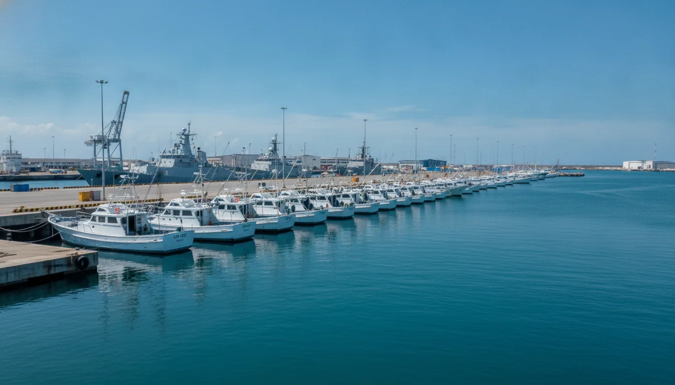
Stand in the port of Lázaro Cárdenas on a September evening in 2026, watching the Navy run the last fishing boats in before the gates close, and you are not witnessing a freak event. You are witnessing the third act of a season that had already staged two of them.
Polo is the record-tying third Category 5 hurricane of the 2026 Eastern Pacific season. Genevieve came first, then Lowell, now this.
Three storms in one basin season reaching the top rung of the Saffir-Simpson scale has happened only three times before in the satellite record: 1994, 2002, and 2018. Now a fourth year joins that list.
The common ingredient each time was a favorable El Niño. In 2026, the pattern delivered precisely the combination the storms needed: sea surface temperatures above 31 degrees Celsius and wind shear knocked low enough that a developing circulation could organize without being torn apart.
All three storms found the same open door. All three walked through it.
That is the detail worth holding onto. Polo did not arrive because the atmosphere produced something unprecedented. It arrived because the atmosphere produced something it has produced before, and is producing more reliably.
The relevant question is not whether the 2026 season was extraordinary. It is whether the conditions that made it extraordinary are drifting toward ordinary.
The data do not yet answer that question cleanly. They ask it with increasing urgency.
Guerrero and Michoacán: The Decisions That Were Actually Made
Tropical storm warnings went up for Guerrero and Michoacán before most residents had finished their morning coffee. The Mexican Navy pulled civilian and fishing vessels from both states' ports — a deliberate economic cost, imposed on purpose, to buy the coast a margin of safety. Compare that to Otis in 2023, which struck Acapulco with almost no useful lead time.
The difference is not luck. It is institutional memory doing its job.
President Claudia Sheinbaum stated publicly that experts considered a direct landfall unlikely. That is a hard sentence to get right. Too much reassurance and people stay put; too much alarm and the credibility of the next warning erodes.
Sheinbaum threaded it: mobilize, but do not panic. The ports closed anyway.
Meanwhile, Polo was already reaching further inland than its track suggested. The storm's moisture fed into the North American monsoon, enhancing thunderstorms across New Mexico even while the center remained offshore. A hurricane does not have to hit land to cost something — flooding hundreds of kilometers from the eye is a real-world consequence, just one that rarely makes the front-page photograph.
Concepción López Villegas put the human stakes plainly: "It is our heritage, our legacy that from one moment to another could be destroyed." That is not poetry. That is the material reality of coastal communities built across generations, priced against a storm that intensified 110 mph in 24 hours.
The port closures and the warnings were not gestures. They were the only levers available before landfall.
The Honest Scorecard: What Forecasting Got Right, and What Hurricane Polo Still Leaves Unanswered
The HCCA consensus model identified Polo as a 99th-percentile intensification event before it peaked. That is the forecast system doing its job: not naming the exact ceiling, but flagging the risk window clearly enough for port closures and warnings to happen before the worst arrived. The Mexican Navy closed Guerrero and Michoacán harbors in time.
The gaps are equally worth naming. Economic losses to Mexican fishing fleets and coastal tourism remain uncounted. The long-term effect of Polo's moisture on monsoon thunderstorms across the US Southwest is unknown, even as that moisture was already enhancing rainfall in New Mexico while the storm spun offshore.
The harder lesson comes from Hurricane Otis, which hit Acapulco in 2023 with a similarly compressed warning window and exposed how little runway even accurate models can provide when intensification is this rapid. Polo's 110 mph gain in 24 hours left residents roughly one news cycle between "tropical storm" and "Category 5."
That is not a forecasting failure. It is a physics problem with an engineering answer.
The lever here is not better panic, it is observational infrastructure: more Hurricane Hunter flight hours, more ocean buoys, better sea-surface data assimilation. Moving from a 24-hour warning to a 48-hour warning is not a slogan. For coastal communities, it is the difference between an orderly evacuation and a prayer.
Hurricane Polo compressed that window to a single news cycle. That investment sits with governments, and it is overdue.